Satellite-Based Forest-Inventory Program in Abu Dhabi

GMV has concluded a demonstration project using satellite imagery to inventory tree plantations in the Emirate of Abu Dhabi. The tree mapping pilot is a spin-off of a larger Emirate-wide habitat and land use/land cover (LULC) project. Both projects are led by Proteus with GMV acting as land remote sensing experts. The Environment Agency – Abu Dhabi (EAD) requested the pilot as it seeks to find an efficient and cost-effective way to monitor the forest stands.
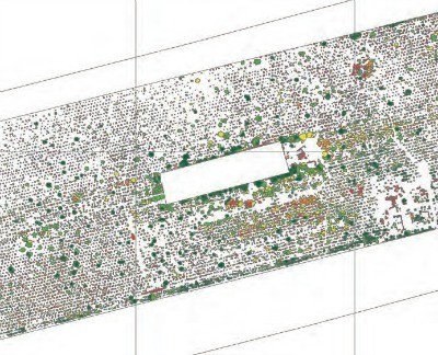
DigitalGlobe’s WorldView-2 multispectral data was processed to identify the species and conditions of individual trees within the pilot area. Image processing techniques were applied using all eight WorldView-2 multispectral bands plus one panchromatic band, with an emphasis on the mid-infrared spectra. This multi-step processing distinguished several tree species by their individual canopies and detected stress, possibly related to irrigation, salinity or infestation issues, in some of the trees.
Proteus managed the project in which GMV performed image processing and automatic tree extraction with local ground-truthing support from Nautica Environmental Associates in Abu Dhabi.
Every tree crown larger than one meter in diameter in the pilot area was mapped with minimal ground truthing and the results were delivered in an Esri geodatabase.