GMV invited to the “Discovery Day event” organized by the FAO

Satellite images are playing an increasing role in our daily lives. They are now a fundamental part of climate-change studies and they also provide us with cartographic information on any part of the world to help us improve our security, manage natural disasters and improve governance of the land and its resources in light of the information they provide.
For some time now GMV has been working very actively in the earth-observation applications market, adding value to satellite images. For example is it currently developing services for precision agriculture and environmental activities.
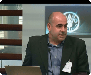
As an expert in remote-sensing and earth observation, GMV has recently been invited to take part in the “Discovery Day Session: The value of Geospatial information for improving land governance”. The event was held in the head office of the Food and Agriculture Organization of the United Nations (FAO) and broadcast round the world in an endeavor to show the advantages and applications of geospatial information.
Antonio Tabasco, head of GMV’s Remote Sensing Applications and Services, presented a paper on how applications of remote sensing systems can help in decision-taking on food-security and infrastructure-development matters. His speech stressed how technology and agriculture can be brought together in high-precision systems based on satellite images.
The event was organized jointly by The United Nations Office for Outer Space Affairs (UNOOSA), the United Nations Economic Commission for Europe (UNECE), DigitalGlobe and the Food and Agriculture Organization of the United Nations (FAO).