Satellite observation applications for the oil and gas sector

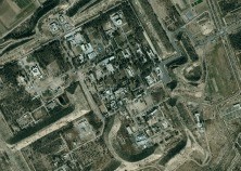
GMV has recently finished an urban change detection analysis for Shell Global Solutions International over Iraq, using Very High Resolution satellite images to ascertain land use and land-coverage (LULC) changes from 2008 to 2015. The mapping standard set by the Multinational Geospatial Co-production Program (MGCP) for 1:50,000 scale maps was adapted in this project to more demanding spatial analysis requirements. Images obtained from the QuickBird satellite for 2008 and the Pleiades satellite for 2015 were then used to build up a Geo-Database (GDB) for comparing the state of spatial elements from one date to another, the statistical analysis of LULC changes and cartographic representation.
The resulting GDB helps Shell International keep up its Corporate Social Responsibility commitments with local communities in 8 major areas: agriculture, industry, dwellings, leisure urban facilities, road upkeep and care of water resources. This project has enabled GMV, as an expert in remote-detection and earth observation, to spread the use of VHR satellite applications into the oil and gas industry and demonstrate the usefulness of these images for projects with a tangible social benefit.