Reference mapping framework contract with the European Union satellite centre

GMV is well aware of the vast potential of very high resolution satellite images. Since 2010 they have been used to meet the demand for basic reference mapping services, especially in remote and hard-to-access areas.
Notable among the most recent applications are the border-surveillance geographic information system provided for FRONTEX as part of a European Space Agency (ESA) project and the sea and land cover classification maps on the basis of 350 images for the Environment Agency of the Emirate of Abu Dhabi, covering a total area of 90,000 km2 and delivered in the record time of 18 months.
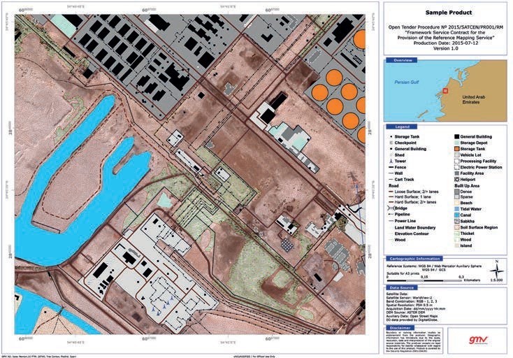
Since Q2 of 2016 GMV has formed part of the group of companies implementing the Framework Service Contract established by the European Union Satellite Centre (EU Satcen) for the Copernicus reference mapping service.
This service offers a considerable improvement on NATO’s international mapping standard MGCP (Multinational Geospatial Co-production Program) in terms of the cataloguing of elements and the final mapping scale. The result of this service is the identification and cataloguing in geospatial databases of over 200 land items, economic uses, cover, infrastructure, transport and other resources.
This service will provide a georeferenced EU-border database with detailed information on hydrography, topography, land cover, infrastructure and main activities of the population. The service will populate the border geographic information system, a basic management instrument for the border-control and -surveillance authorities.